Guide
Is drone photography worth it for your listing?
Sometimes the aerial is the shot that sells the house. Sometimes it is two hundred dollars for a picture of a roof. Here is how to tell which one you have before you pay for it.
01
What a drone actually shows a buyer
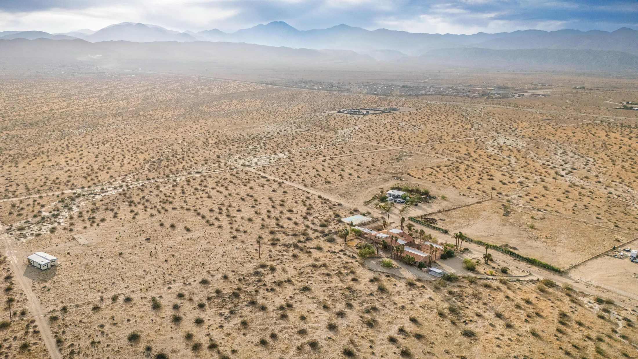
An aerial frame answers questions a ground level photograph simply cannot. How big is the lot. What is behind the house. How close is the neighbour. Where does the property sit in relation to the mountains, the fairway, the wash.
That is the test. If somebody would form a genuinely different impression of the property after seeing it from sixty feet up, the drone is doing real work. If they would not, it is decoration.
02
When it is clearly worth it
Some properties are close to impossible to represent honestly from the ground, and there are more of them here than in most markets.
- Large or unusually shaped lots, where the ground view understates the land
- Golf course frontage, where the relationship to the fairway is the selling point
- Mountain or valley views that only resolve above the roofline
- Properties with a lot of outdoor space: pool, casita, courtyard, multiple patios
- Anything acreage or equestrian, where the boundary matters
- New builds in developing areas, where context reassures rather than worries
03
When I will tell you to skip it
A mid block tract home on a standard lot with neighbours close on both sides. From the air that house looks like every other house on the street, and the aerial quietly draws attention to the one thing you would rather nobody dwelt on.
Condos and attached units, same story. An aerial of a condo building shows a roof and a parking lot. The interior and the amenities are what sell it.
And anywhere the immediate surroundings are the weak point. The camera is honest about what is next door, which is lovely when the answer is a golf course and less lovely when it is a storage yard.
04
The legal part that most listings ignore
Flying a drone commercially in the United States needs a federal remote pilot licence. That is not a best practice, it is the law, and it applies to anyone flying for a business purpose, including photographing a listing.
It matters to you as well as to whoever is flying. Some brokerages want a pilot's licence on file before they will publish aerial images, and a listing marketed with unlawfully captured photography is not a problem you want attached to a transaction.
It is a fair thing to ask anyone quoting you for drone work, and a licensed one will not mind being asked.
05
Airspace in the Coachella Valley is not uniform
The valley has real airspace constraints that decide what can be flown and where. Palm Springs International sits in the middle of the market, and Bermuda Dunes and Jacqueline Cochran are both active. Properties inside controlled airspace need authorisation before a flight, which is routine but not instant.
The practical effect is scheduling. If a property is near an airport, flag it when you book rather than finding out on the day.
06
How many aerials a listing actually needs
Two to four. One wide frame showing the property in context, one showing the lot boundary and the back yard, and one or two lower down that read almost like elevated ground shots.
After that you hit diminishing returns fast. Fifteen aerials in a gallery of thirty is a listing that looks like it is hiding the interior.
Not sure whether yours is worth it? Send me the address. If it is not, I will say so.
- Steven
Questions
Is drone photography worth it for your listing?: common questions
How much does drone photography cost?
It is a $200 add-on to any listing shoot, covering the flight and the edited aerial images delivered alongside the rest of the set.
Can you fly in windy conditions?
Up to a point. The valley gets genuine wind, particularly through the San Gorgonio Pass and around Palm Springs, and there are days where flying would be unsafe or would produce unusable footage. If that happens we reschedule the flight rather than push it.
Do you need permission from the homeowner?
Yes, and from whoever controls the property. For gated communities and HOAs it is worth checking their rules in advance, since a few restrict drone flights regardless of any other authorisation.
Can drone footage be used for video as well as stills?
Yes. If you want aerial video for a listing reel as well as stills, mention it when booking so the flight is planned around both.
What areas do you cover?
The whole Coachella Valley. I shoot regularly in Palm Springs, Palm Desert, La Quinta, Rancho Mirage, Indio, Cathedral City, and Desert Hot Springs, and I am happy to travel anywhere in the valley at no extra charge. There is a page for each city and service below with the details for that area.
- Real Estate in Palm Springs
- Real Estate in Palm Desert
- Real Estate in La Quinta
- Real Estate in Rancho Mirage
- Real Estate in Indio
- Real Estate in Cathedral City
- Real Estate in Desert Hot Springs
- Events in Palm Springs
- Events in Palm Desert
- Events in La Quinta
- Events in Rancho Mirage
- Events in Indio
- Events in Cathedral City
- Events in Desert Hot Springs
- Headshots in Palm Springs
- Headshots in Palm Desert
- Headshots in La Quinta
- Headshots in Rancho Mirage
- Headshots in Indio
- Headshots in Cathedral City
Ready when you are
Ten years of shoots across the Coachella Valley. If you would rather talk it through than read another list, that works too.
Add drone to a shootKeep reading
- What real estate photography costs, and whyAgents ask me this before anything else, so here is the whole answer, including the parts that do not flatter my own pricing.
- The best time of day to photograph a desert homeDesert light does not behave like light anywhere else, and scheduling a shoot as though it does will cost you the photographs you were after. This is how I plan around it.
Let's plan your shoot
Let's get your shoot started.
Pick what you need photographed and add your name and email. That is all I need to reply, usually within one business day.